Underground Railroad Map and Routes (Overview of the Escape from
Slavery)
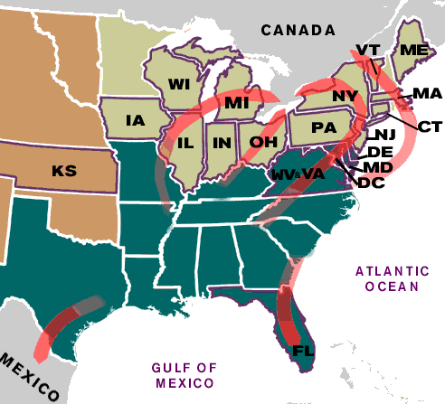
Underground Railroad Map and Routes (Overview) |
Underground Railroad Map and Routes: Overview of the Escape from
Slavery
The following Underground Railroad Map shows an overview of the free
states in the North and the slave states in the South together with
routes to freedom leading to the North and Canada or further south
to Mexico and the Spanish territories of Florida with access to the
islands of the Caribbean.
Underground Railroad Map and Routes: Balance between Free States and
Slave States
Slavery had been excluded from
the Northwest by the
Northwest Ordinance of 1787. The
Fugitive Slave
Act imposed harsh penalties on runaway
slaves and the people who helped them. After 1812 up
to the
American Civil war (1861-1865), maintaining the balance of free and slave states
was considered of paramount importance by the federal legislature if
the Union were to be preserved. The
Missouri Compromise maintained
the balance by admitting Missouri as a slave state and Maine as a
non-slave state at the same time, retaining the balance between
slave and free states. New states entering the Union were often
admitted in pairs. The Arkansas Territory was opened to slave states
by the Missouri Compromise, the unorganized territory in the west
was closed to slavery by the Missouri Compromise. The
Second Great Awakening
resulted in the Abolitionist
Movement which became active following
Nat Turner's Rebellion and
the establishment of the
Underground Railroad. Also
refer to Underground
Railroad Symbols and Secret Codes.
Underground Railroad Map and Routes: Free States
Underground Railroad Map indicates the free states that were
Illinois, Indiana, Ohio, Pennsylvania, New York, New Jersey,
Connecticut, Rhode Island, Massachusetts, Vermont and Maine.
Underground Railroad Map and Routes: Slave States
Underground Railroad Map
indicates the slave states that
consisted of Alabama, Arkansas, Delaware, Florida, Georgia,
Kentucky, Louisiana, Maryland, Mississippi, Missouri, North
Carolina, South Carolina, Tennessee, Texas, and Virginia.
Underground Railroad Map and Routes: Detailed Map, the Escape from
Slavery
The detailed Underground Railroad Map provides indications of the
many escape routes taken by fugitive slaves. There were escape
routes over land and escape routes traveling by water. The decision
to run from slavery was extremely dangerous. The slaves were
undertaking long and arduous routes and it was necessary to use
hiding places along the way. The hiding places were not only
"safe houses but the natural environment also offered protection.
Uninhabitable areas such as
swamps, bayous and waterways
provided much needed protection throughout their journey and these
areas are indicated on the detailed Underground Railroad Map and
Routes.
Detailed Underground Railroad Map and Routes, the Escape from
Slavery
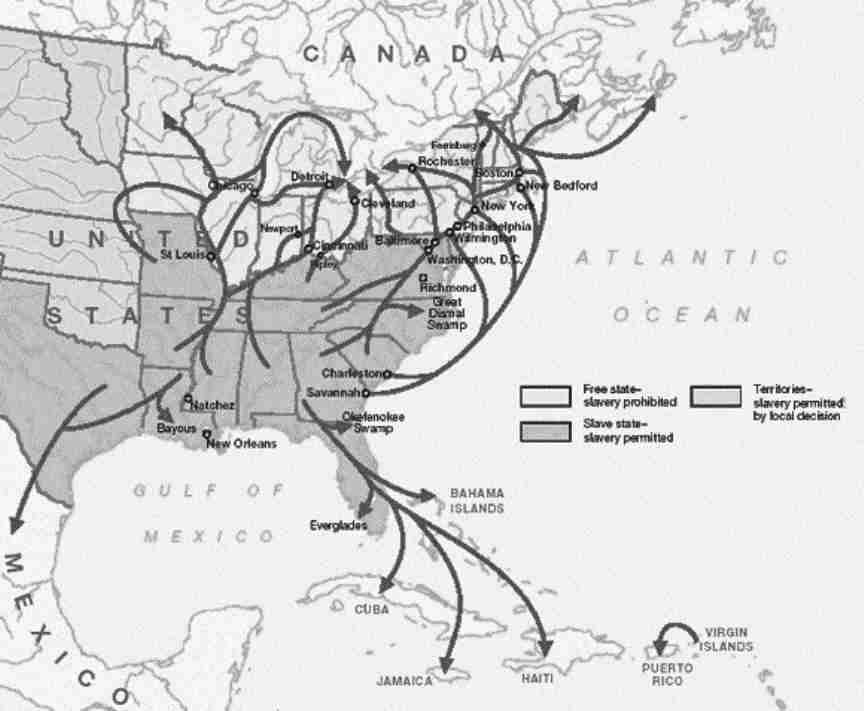
Detailed Underground Railroad Map and Routes, the Escape from
Slavery
Black
History for kids: Important People and Events
For visitors interested in African American History
refer to Black History -
People and Events.
A useful resource for
teachers, kids, schools and colleges undertaking projects for the
Black History Month.
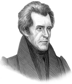
Underground Railroad Map - President Andrew Jackson Video
The article on the
Underground Railroad Map provides information about one of the Important
events of his presidential term in office. The following
Andrew Jackson video will
give you additional important facts and dates about the political events experienced by the 7th American President whose presidency spanned from March 4, 1829 to March 4, 1837.
Underground Railroad Map
●
Interesting pictures of the Underground Railroad Map for kids
●
Underground Railroad Map for kids
●
The Underground Railroad Map - Free States and Slave States
●
Andrew Jackson Presidency from March 4, 1829 to March 4, 1837
●
Fast, interesting
map
about the Underground Rialroad
●
Foreign & Domestic
policies of President Andrew Jackson
● Underground Railroad
Map for schools,
homework, kids and children
|